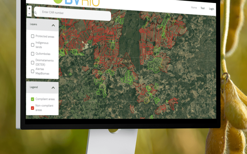
A new free soy production map and tool for assessing deforestation and conversion of native vegetation at the farm level for production areas in the Brazilian Cerrado region is now available.
The tool, developed by BVRio, covers over 92,000 farms, an area of over 61 million ha, and with only a farm CAR Number, users can quickly and easily see if there are any deforestation indicators associated with farms in their supply chain. Farms themselves can also access the free tool in order to provide data to their buyers.
BVRio director, Grace Blackham leads the project, which is funded by the Waterloo Foundation. “There is a wealth of publicly available and trusted data on land use change in Brazil, but there wasn’t an easy way for individuals to navigate it and check for deforestation or conversion of native vegetation on individual farms. Building on our experience in creating our Brazilian Timber Due Diligence system, and driven by the increasing demand for agricultural commodity traceability due to regulation tightening, we created this new soy production map and tool.”
New legislation in the EU will soon require that commodities such as soy are not placed or made available on the EU market, or exported from the EU, unless they are deforestation-free after a cut-off date of December 31, 2020 and have been produced in accordance with the relevant legislation of the country of production. While the regulation initially only includes forests, thereby excluding much of the Cerrado, it is widely expected that “other forested land” will be included in the first update, and that this will bring the Cerrado under the regulation. Commodities will need to be traced from the farm they are produced on using polygons with sufficient latitude and longitude points to describe the perimeter of the area.
The free-to-use tool is available here and does not require a login or registration to use. Additional checks and data are expected to be added to the tool later this year.